
Guadalcanal’s Bloodiest Battle – Bloody Ridge Project
The Battle of Bloody Ridge, also known as the Battle of the Edson’s Ridge, was one of the …

Kinoya Waste Water Project
Project Snapshot Kahuto Pacific was contracted by Scope Pacific Engineers to carry out a LiDAR and Photogrammetry survey …
Uncovering WWII Heroes with Drone LiDAR & Magnetometry
The team equipped with the DJI M300 and a Livox R2A (LiDAR) Sensor faced a unique challenge. We …
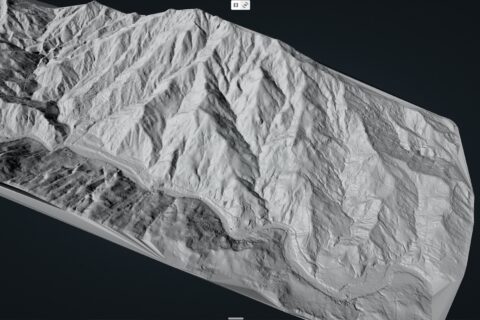
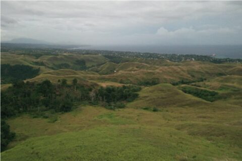
LiDAR Survey of 2500 acre Gold Project
The client needed accurate contours and DEM (Digital Elevation Model) for the challenging 2500 acre site. Mine engineers …
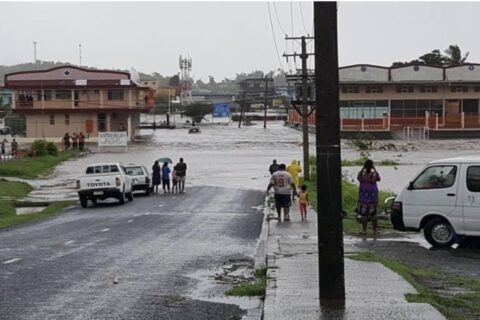
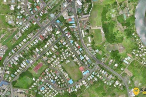
Drone LiDAR Flood Mapping Fiji
Kahuto Pacific on behalf of Pacific Community-SPC captured an aerial LiDAR survey to produce a Digital Elevation Model (DEM) for flood …
Filling the Spatial Data Gap in the Pacific
Kahuto Pacific’s aerial drone services deliver the highest quality data capture solutions that enable accurate digital representations of …
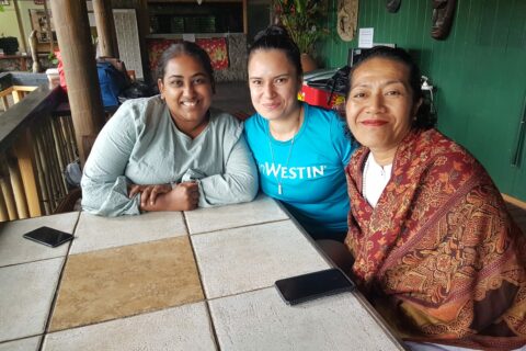
Social entrepreneurs pivoting, testing and adapting in the Pacific Islands
Last year, Kahuto was fortunate to be apart of the SFI Resilience Program to assist social entrepreneurs in adapting to …
Engineering and Surveying consultants save time and costs using aerial drone to capture aerial topographic surveys
In 2020, Fijian based engineering consultancy SCoPE Pacific Ltd needed an accurate and cost effective solution to capture …