LiDAR Survey of 2500 acre Gold Project
LiDAR Survey of 2500 acre Gold Project
Project Snapshot: Lion One Tuvatu Gold Project – Fiji
Client – Lion One Metals Ltd
Scope of Project
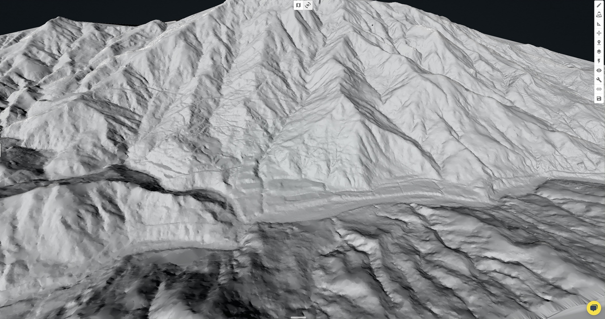
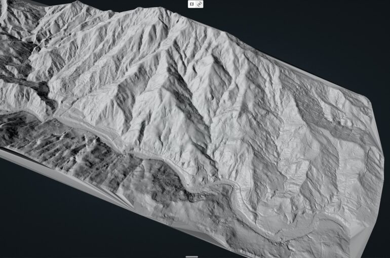
The client needed accurate contours and DEM (Digital Elevation Model) for the challenging 2500 acre site. Mine engineers and planners needed an accurate baseline dataset to begin planning and design of key mine infrastructure.
Solution
To capture the 2500 acres of aerial LiDAR and photogrammetry, the locally based team in Fiji used a DJI M300 carrying a R2A Livox LiDAR sensor and Zenmuse P1 camera. Control survey and flight plan details were done by the team at Kahuto to ensure the required point density will be captured in the most efficient manner possible. Prior to the aerial LiDAR flights, a ground control survey was conducted by registered surveyors, Wood and Jepsen Consultants.
Challenges
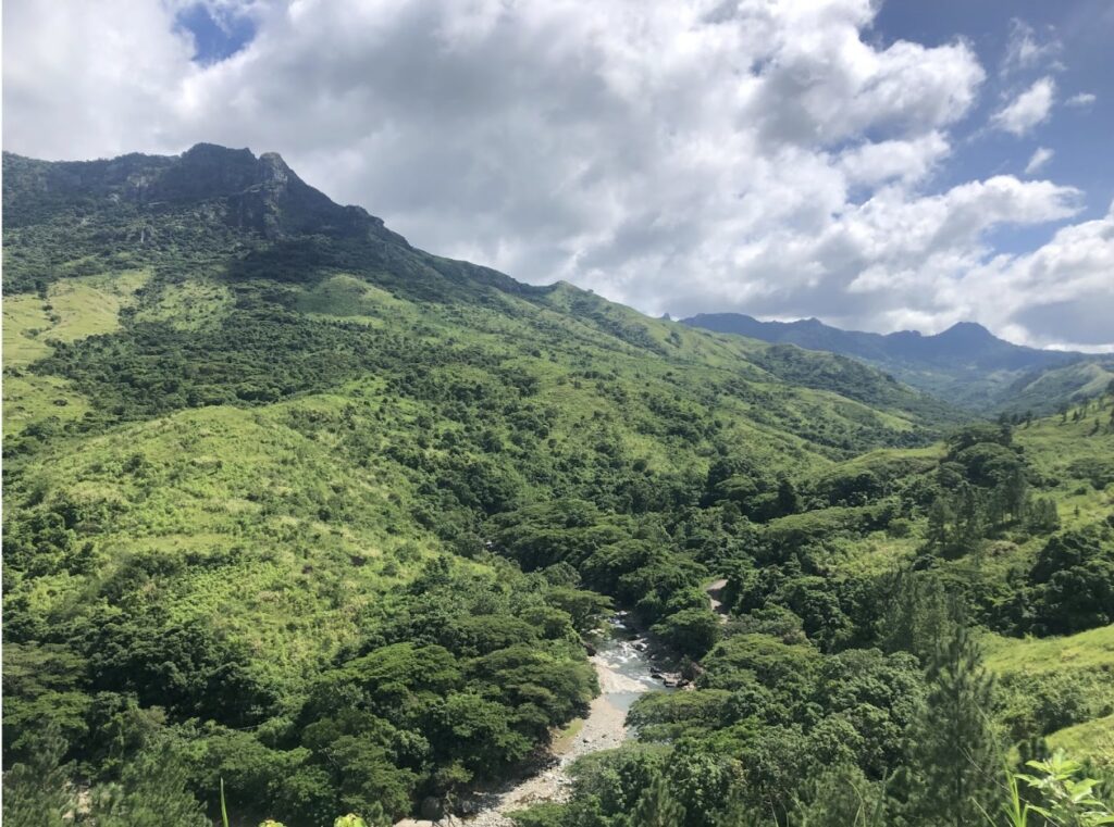
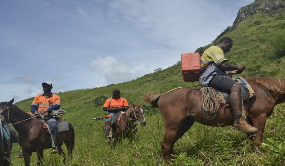
- The project started at the height of Fiji’s wet season, causing delays and damage to access roads across the site. Horses were required for both the ground survey and drone survey teams.
- Mountainous terrain with dense vegetation made accessing the and capturing the site difficult.
- Large number of flights required to complete the site capture with the point density required. A total of 41 flights were completed across a steep, vegetated terrain.
Results
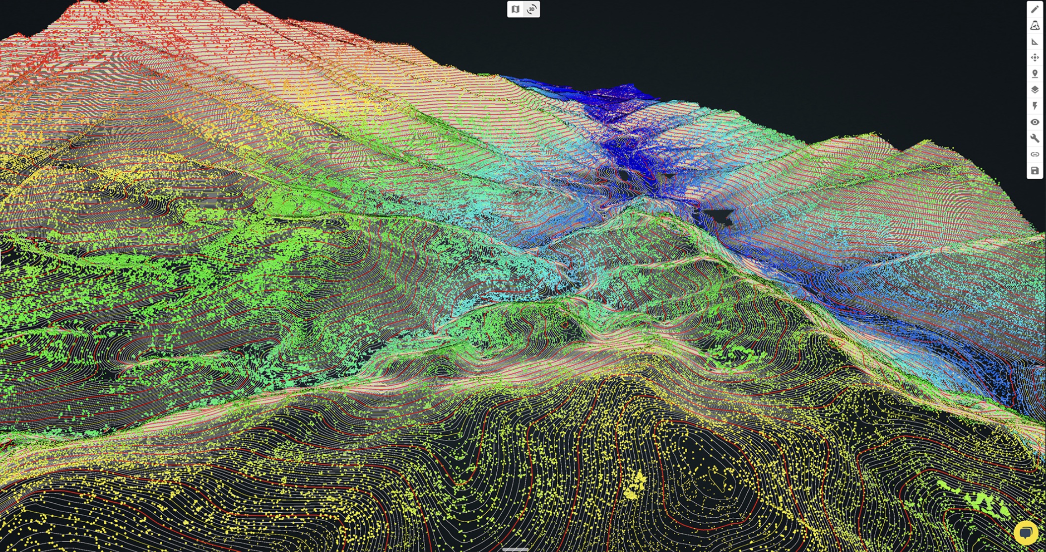
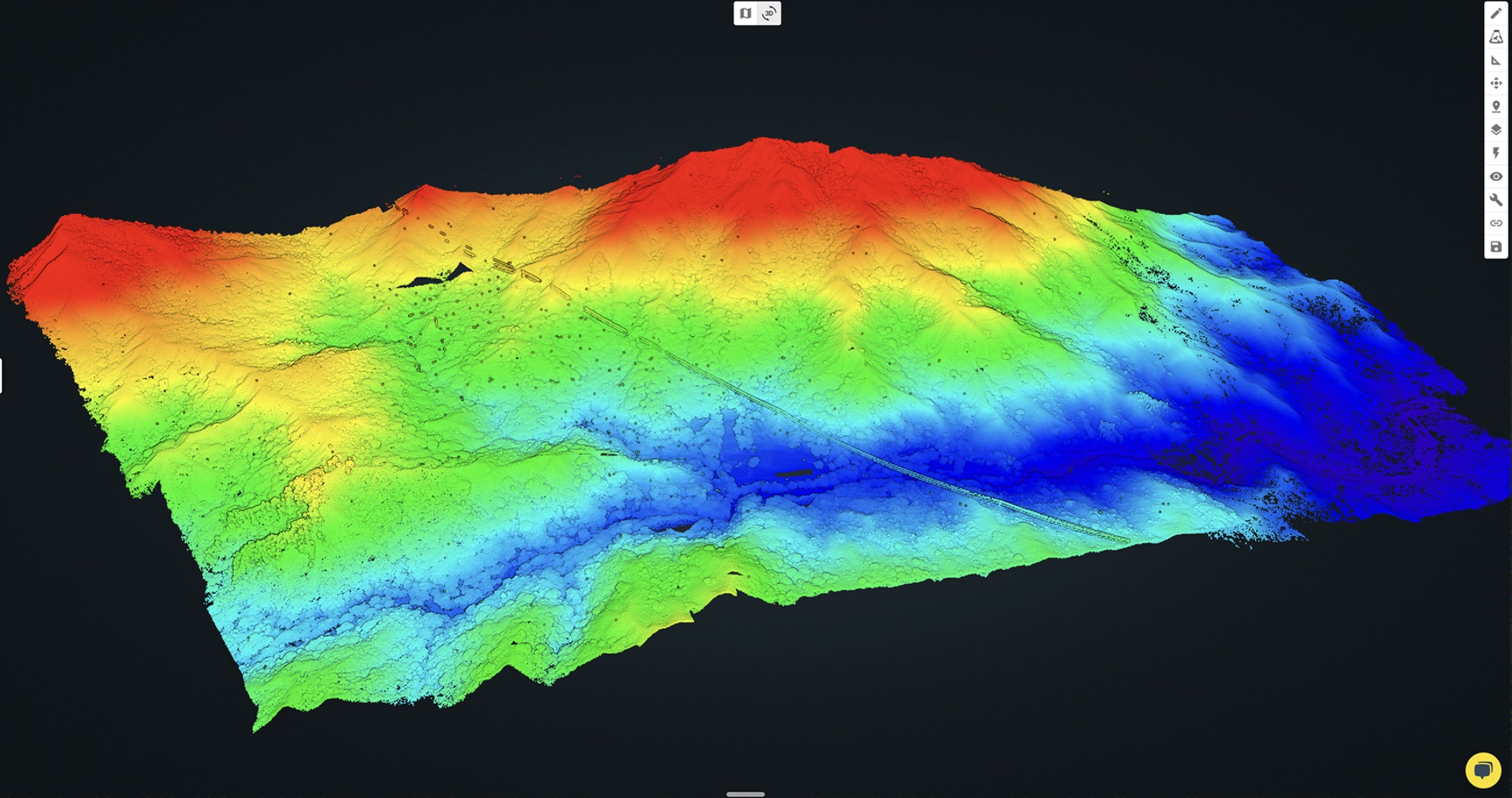
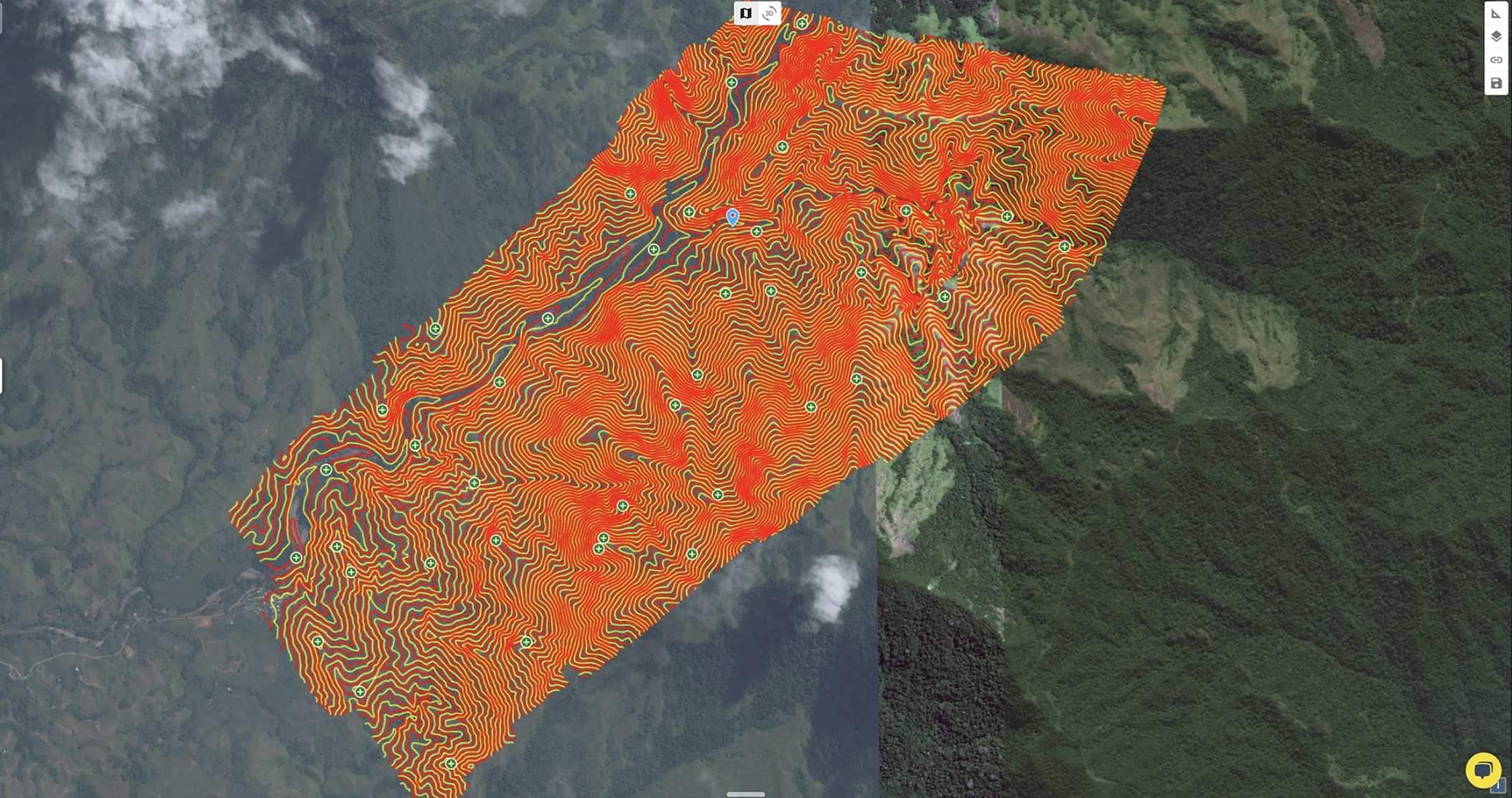
The Drone LiDAR, Imagery and GNSS survey combined were used to generate a complete site model for baseline topography. A staggering 4 billion points of data was collected and processed into the below deliverables.
- Bare Earth surface (DEM), Digital Surfacel Model (DSM) as 1m Resolution RASTER and DWG
- Contours at 0.5m minor and 1m major as DWG
- Ortho Photo at 3cm GSD (RGB) as GeoTif
- Feature classification
- Classified Point Cloud