
Guadalcanal’s Bloodiest Battle – Bloody Ridge Project
The Battle of Bloody Ridge, also known as the Battle of the Edson’s Ridge, was one of the …

Kinoya Waste Water Project
Project Snapshot Kahuto Pacific was contracted by Scope Pacific Engineers to carry out a LiDAR and Photogrammetry survey …
Uncovering WWII Heroes with Drone LiDAR & Magnetometry
The team equipped with the DJI M300 and a Livox R2A (LiDAR) Sensor faced a unique challenge. We …
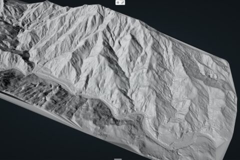
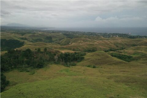
LiDAR Survey of 2500 acre Gold Project
The client needed accurate contours and DEM (Digital Elevation Model) for the challenging 2500 acre site. Mine engineers …
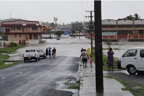
Drone LiDAR Flood Mapping Fiji
Kahuto Pacific on behalf of Pacific Community-SPC captured an aerial LiDAR survey to produce a Digital Elevation Model (DEM) for flood …