Drone LiDAR Flood Mapping Fiji
Drone LiDAR Flood Mapping Fiji
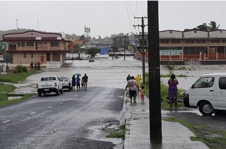
In Fiji and across the wider Pacific, flash floods are common hazardous events that pose a serious threat to populations. Fiji has a diverse topography with mountainous regions and low-lying coastal areas. The combination of steep slopes and El Nina weather patterns can lead to heavy rainfall leading to flash floods in the low-lying areas.

In Fiji and across the wider Pacific, flash floods are common hazardous events that pose a serious threat to populations. Fiji has a diverse topography with mountainous regions and low-lying coastal areas. The combination of steep slopes and El Nina weather patterns can lead to heavy rainfall leading to flash floods in the low-lying areas.
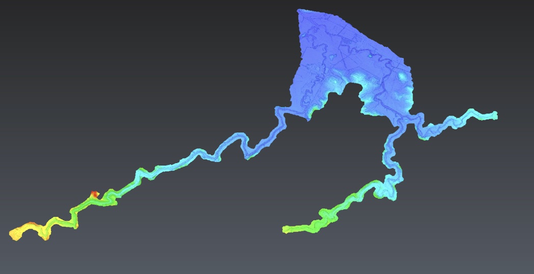
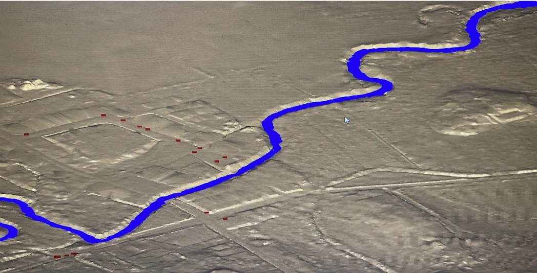
Kahuto Pacific on behalf of Pacific Community-SPC captured an aerial LiDAR survey to produce a Digital Elevation Model (DEM) for flood modeling of the Penang River catchment (Rakiraki), Fiji.
The activity is part of the “Hydrology support for flash flood early warning systems” project which is funded by the Australian Water Partnership (AWP). The project is focused on providing technical support in hydrology to Fiji, Samoa, Solomon Islands and Vanuatu with an emphasis on strengthening Flash Flood Early Warning Systems. The overarching purpose of the project is to increase climate resilience and strengthen Disaster Risk Reduction (DRR) systems in Pacific Island Countries through increased hydrological capacity and enhanced performance of flood early warning systems.
Project Snapshot
Client – The Pacific Community (SPC)
Scope of Project
SPC Hydrologists needed a Digital Elevation Model (DEM) derived from airborne LiDAR for the purpose of flood modeling the Penang Catchment in Rakiraki, Fiji for early warning flood systems.

Solution
To capture the 600 hectares of aerial LiDAR the locally based team in Fiji used a DJI M300 carrying a R2A Livox LiDAR sensor. Control survey and flight plan details were conducted by the team at Kahuto to ensure the required point density will be captured in the most efficient manner possible. Prior to the aerial LiDAR flights a ground control survey was conducted by registered surveyors, Wood and Jepsen Consultants.

Challenges
- The project started in the peak of the wet season, causing major delays with the data acquisition.
- Large number of flights required to complete the site capture with the point density required.

Results