Uncovering WWII Heroes with Drone LiDAR & Magnetometry
Uncovering WWII Heroes with Drone LiDAR & Magnetometry
Project Snapshot
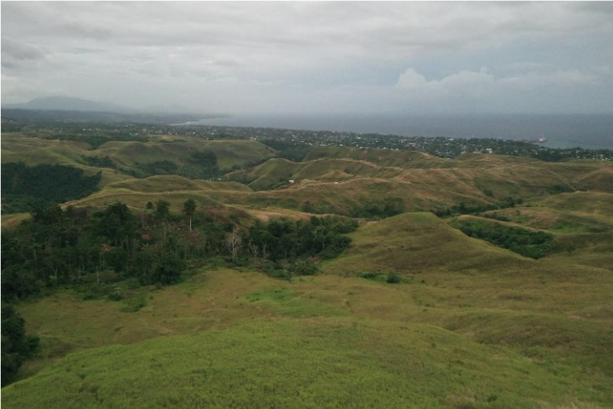
The dense jungles of the Solomon Islands have long held the secrets of a pivotal chapter in history. Here, amidst the towering trees and hidden valleys, lie the remnants of World War II. These hills, once the stage for fierce battles between Allied and Japanese forces, are now the focus of a remarkable mission — one that seeks to uncover and honor the heroes who fought on these distant shores.
In a groundbreaking endeavour that combines cutting-edge technology with historical preservation, a US team of researchers, archaeologists from the International Archeological Research Institute Inc, Professors from Binghamton University, and Kahuto Pacific’s drone experts is embarking on a journey of rediscovery. Through the use of Drone LiDAR (Light Detection and Ranging) surveys, they aim to peel back the layers of the thick dense vegetation and canopy, while the use of Magnetometry is purposely for scanning metal objects underground with a targeted approach from the Aerial survey data. Take in mind this is a first of its kind exercise in the world.
Client – DPAA in association with IARII & Binghamton University
Scope of Project
The clients required an accurate aerial LiDAR survey over thick vegetated mountain ridges and valleys, to compare and match old records of World War 2 to recreate possible tracks and fox-holes US military took. This data is crucial to aid in its search to recover fallen soldiers of war.
Solution
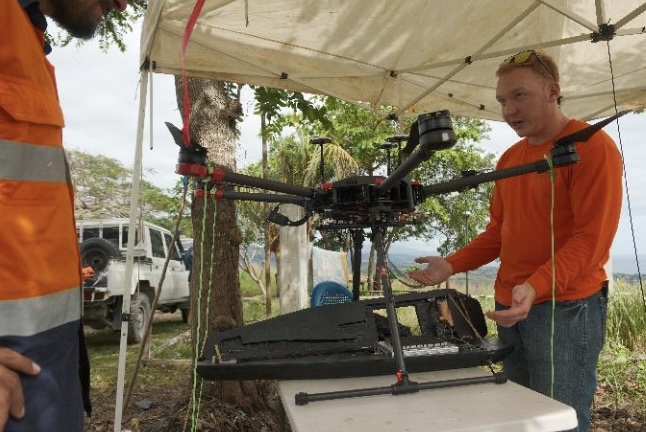
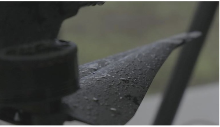
The team equipped with the DJI M300 and a Livox R2A (LiDAR) Sensor faced a unique challenge. We needed to fly at a low altitude to produce the most accurate results. This low-altitude, high resolution approach was essential for penetrating the dense jungle. The combination of the DJI M300’s precision flight capabilities and the LiDAR sensor’s ability to see between the thick foliage made the duo the ideal choice for the mission.
Challenges
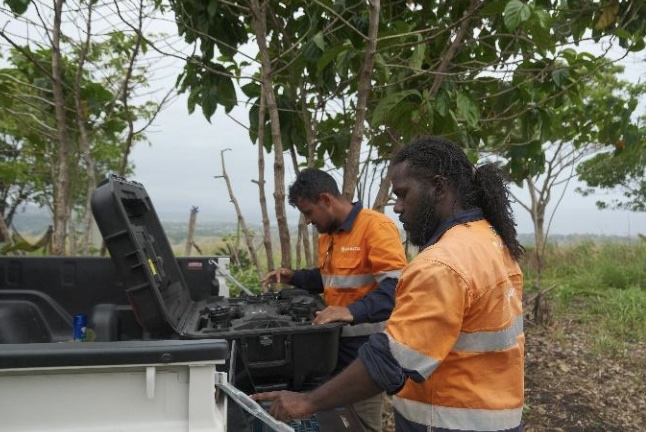
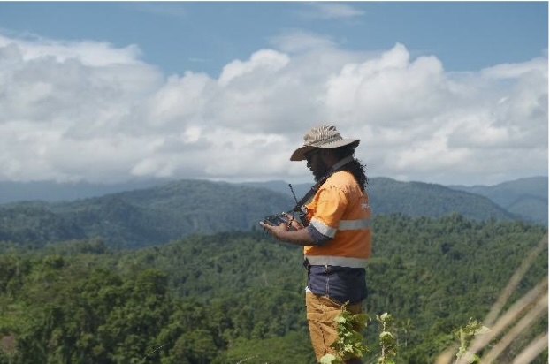
While the drone maintained a low-altitude flight at 30 meters following the harsh terrain, it occasionally vanished from view as it navigated over hills or descended into valleys. These challenges, although demanding, served as inspiration for the team to think creatively and make rapid decisions, especially given the elevated altitude, unpredictable winds and rapidly changing weather conditions. A lot of positives to take on these challenges.
Results
With the team flying lower and slower than we have ever done the results were interesting to see. With these flight parameters we were able to capture 250,000,00 points within 4Ha, which is super dense.
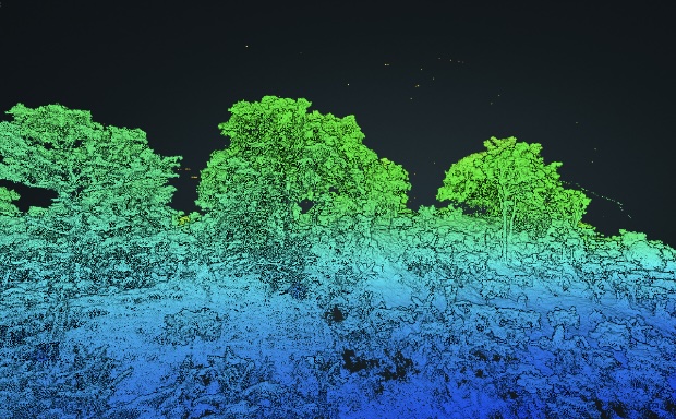
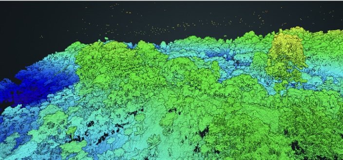
The point cloud data is generated initially from the recorded angular and range measurements from the LiDAR in the field, followed by tightly coupling the IMU to post processed GNSS to form an accurate trajectory or flight path. Finally this trajectory, combined with the time stamped range measurements generated by the lidar are used to form the 3d point clouds per flight.
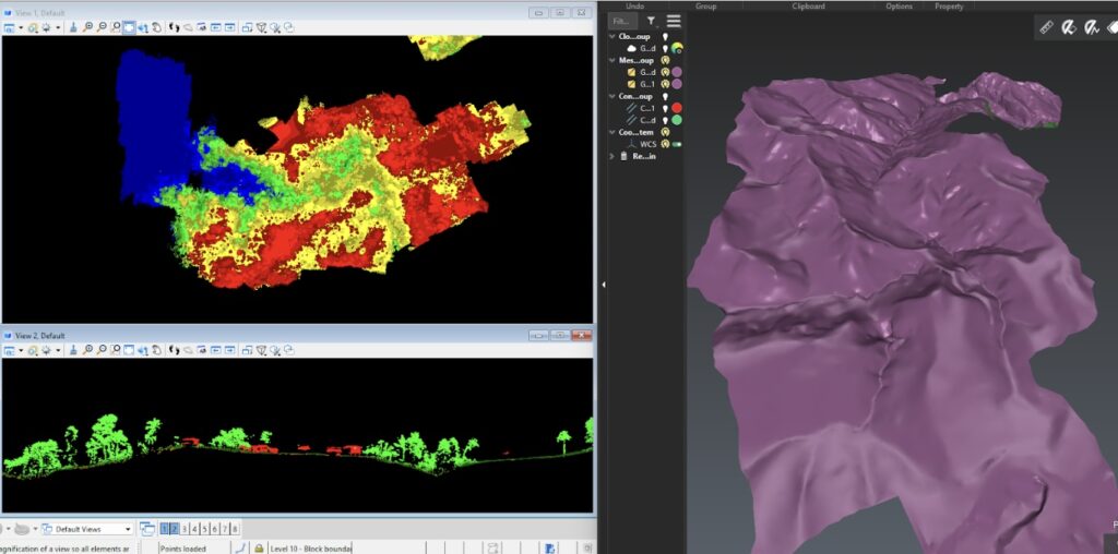
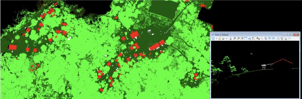
These point clouds have been matched together to improve accuracy and then classified which involves essentially grouping points of similar attributes to industry standard classes or layers.
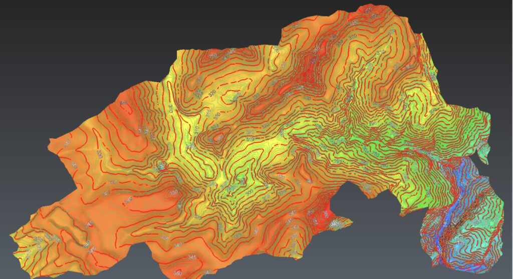
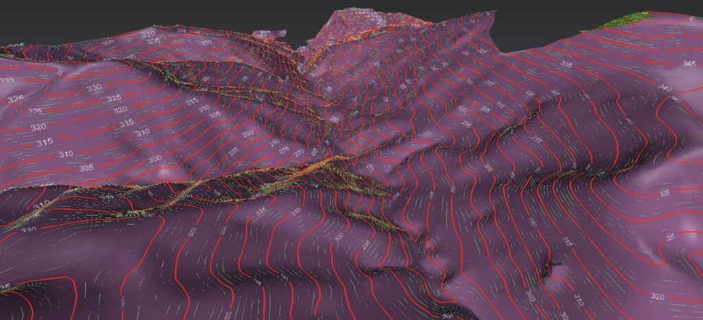
These classes are used to assist in generation of final deliverable products such as digital elevation (bare earth) or digital surface models known as DEM or DSM respectively, to allow users to analyze different land cover features, or to ensure accurate generation of topographic products such as contour lines, which we have generated for this project by generating a DTM from the ground only points, then using this to generate accurate contour lines on the jungle floor.
These classes can be seen here below in different colours, as well as the contour lines derived from the bare earth surface.
This data will be used by the client to assist in assessing the terrain, land cover, vegetation height and generate a digital twin of the terrain for future analytics over the course of the project.
Kahuto Pacific pride ourselves on working with our clients to provide geospatial solutions to a variety of project challenges using industry leading technology and advanced software workflows, ensuring we are a trusted mapping provider in the Pacific region.