Projects
November 28, 2021 2023-11-29 9:38Projects
Uncovering WWII Heroes with Drone LiDAR & Magnetometry
The team equipped with the DJI M300 and a Livox R2A (LiDAR) Sensor faced a unique challenge. We needed to fly at a low altitude to produce the most accurate results. This low-altitude, high resolution approach was essential for penetrating the dense jungle. The combination of the DJI M300’s precision flight capabilities and the LiDAR sensor’s ability to see between the thick foliage made the duo the ideal choice for the mission.
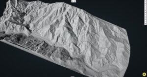
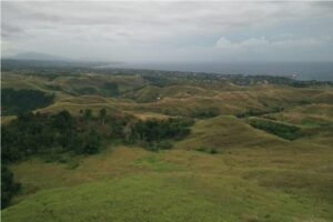
LiDAR Survey of 2500 acre Gold Project
The client needed accurate contours and DEM (Digital Elevation Model) for the challenging 2500 acre site. Mine engineers and planners needed an accurate baseline dataset to begin planning and design of key mine infrastructure.
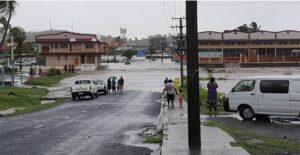
Drone LiDAR Flood Mapping Fiji
Kahuto Pacific on behalf of Pacific Community-SPC captured an aerial LiDAR survey to produce a Digital Elevation Model (DEM) for flood modeling of the Penang River catchment (Rakiraki), Fiji.