fbpx

Aerial Topographic Surveys in Fiji

immediate cost and time savings

Aerial topographic surveys

Aerial topographic surveys can offer immediate cost and time savings in pre-development surveys in Fiji, Solomon Islands & the Pacific Islands.

When beginning any land development project, development professionals turn to publicly available land and spatial information to begin pre development planning and due diligence.

In Fiji, the Solomon Islands and most other the Pacific Islands there is a significant gap in publicly available land and spatial information compared to what our neighbours enjoy in Australia and New Zealand.

The Problem

Out of date surveys and GIS Information on site

Many of the datasets that are available are often old and outdated, this includes aerial imagery, topographical maps and other GIS information that enable thorough pre development planning.

The initial lack of data can lead engineering consulting firms into making costly assumptions. This often results in firms engaging in costly and time consuming land terrestrial surveys for preliminary design work and feasibility studies.

Kahuto Pacific have been supporting architects, engineers, surveyors and other land development professionals in Fiji, the Solomon Islands and the Pacific Islands by providing fast and cost effective aerial topographic surveys.

The Solution

Aerial topographic surveys

With a professional, commercial drone, it is possible to carry out aerial topographic surveys of the same quality as the highly accurate measurements collected by traditional survey methods, but in a fraction of the time.

This substantially reduces the cost of a site survey and the workload of specialists in the field.

Our GIS technicians can extract features from the aerial images such as signs, curbs, road markers, man hole covers and drains reducing the time spent by technicians in the field.

After post-processing with a photogrammetry software, these same images can produce very detailed elevation models, contour lines and break-lines, as well as 3D reconstruction of land sites or buildings.

CAD Ready

All our deliverables are CAD ready and can be loaded into all major GIS, surveying, civil and architecture planning and design software.
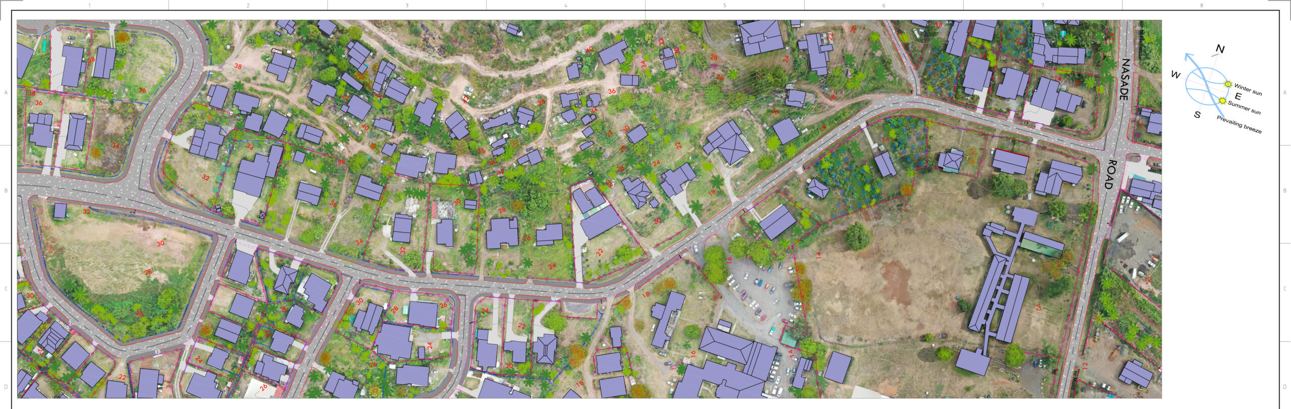
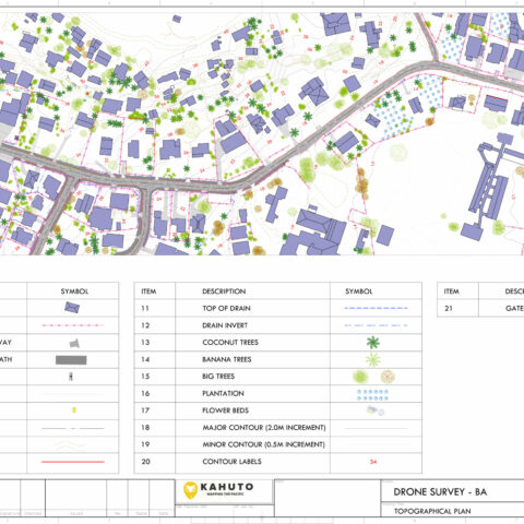
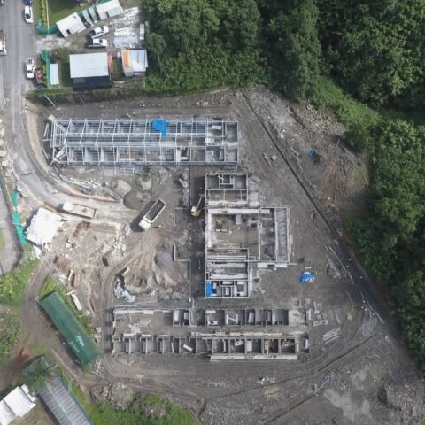
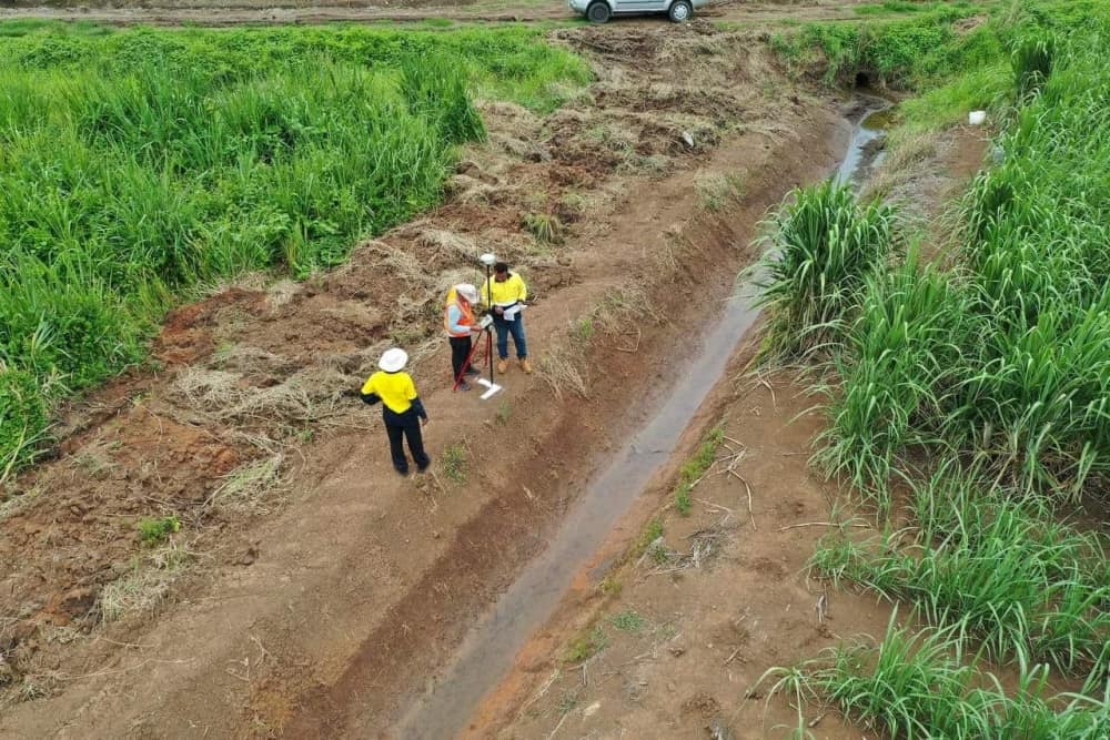
Using UAV or drones, we’ve been conducting aerial topographic surveys which have proven much quicker and meet the accuracy required for architectural and engineering design. We’re now also using drones for our traffic surveys and Kahuto can capture what we need in just an hour. And that’s the benefit - when you’re looking at cost benefits, it’s a no brainer.
Michael Whippy
Director & Registered Surveyor, Pro Survis

Birds Eye Benefits

What are you trying to capture? Chances are, it's easier, faster, more effective and most accurate from the sky.

Hit The Mark

Our aerial topographic surveys help reduce uncertainty and replace assumptions with facts, making your operational decisions safer, more efficient and more cost effective.

Time Efficiency

Why waste your precious time wrangling logistics, crews and countries? Our smart solutions get you enhanced results in hours, not weeks.

Better Bottom Line

When you work smart, you increase your profit margin. Timely, cost-effective and detailed data collection means more money in the bank.

Premium Fleet

We're experienced, qualified and safe, delivering quality results on time, on budget and with a Pasifika smile. Which is why our clients return again and again.